
El Niño 2026: How Strong It Is and What It Means for Winter
- 2 views
- 0 likes
- 0 comments
- All languages combined
In short
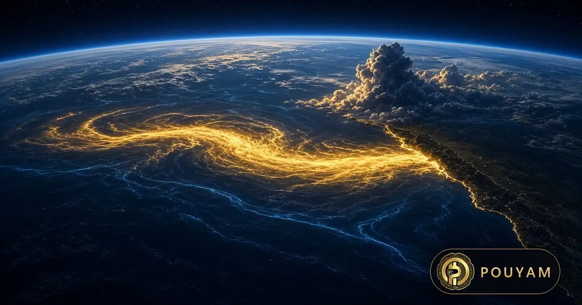
As of 12 November 2026, NOAA says El Niño is still strengthening, with a strong-to-very-strong event likely through January-March 2027 (above 79% chance) and about a 60% chance it becomes the strongest since 1950 [1]. WMO expects a peak around December 2026, with effects lasting well into 2027 [3][4].
Key takeaways
- NOAA's Climate Prediction Center kept its El Niño Advisory on 12 November 2026; the Niño-3.4 index reached +2.5°C and parts of the eastern Pacific were more than 4.0°C above average [1].
- NOAA puts the chance of a strong-to-very-strong El Niño through January-March 2027 above 79%, and the chance of a historic event (a 3-month Relative Oceanic Niño Index, RONI, of +2.5°C or more) at about 60% for October-December and November-January [1].
- WMO's latest seasonal update forecasts a Niño-3.4 anomaly of about +3.8°C for November 2026 to January 2027, peaking around December 2026 [3].
- For the US winter, NOAA favours a warmer north and a wetter south from California to Florida and along the East Coast [7].
- WMO stresses that strength alone does not decide impacts in any one country; other drivers, such as the Indian and Atlantic Oceans, can change the outcome [2][4].
- El Niño is a natural climate pattern and is not caused by climate change, WMO says, although human activity increasingly shapes what each event does [2][4].
On this page 12 sections
- Is El Niño happening in 2026?
- How strong will El Niño 2026 get?
- When will El Niño peak and end?
- What does El Niño mean for winter weather?
- What are the effects of El Niño around the world?
- What is El Niño, and is it caused by climate change?
- How should you prepare for El Niño?
- What is still uncertain?
- Common mistakes
- Frequently asked questions
- Glossary
- Sources
Is El Niño happening in 2026?
Yes. El Niño is under way and still strengthening: NOAA's Climate Prediction Center (CPC) kept its official El Niño Advisory in place on 12 November 2026 [1]. An advisory is issued when El Niño conditions are observed and expected to continue [9].
The CPC reported that sea surface temperature anomalies exceeded 4.0°C in parts of the eastern equatorial Pacific and that the main index, Niño-3.4, rose to +2.5°C, with +3.6°C in Niño-3 and +4.4°C in Niño-1+2 near South America [1]. Below the surface, temperatures at depth in the eastern Pacific were more than 10.0°C above average [1]. The atmosphere is responding in the classic El Niño way: rainfall is enhanced from the central to the eastern Pacific and suppressed over Indonesia [1].
The event grew quickly. WMO says the Niño-3.4 region still showed weak La Niña conditions at the start of 2026, then its temperature anomaly rose by more than 1.5°C between March and August; El Niño conditions emerged in June and were firmly established by mid-August [6].
How strong will El Niño 2026 get?
Forecasters expect a strong to very strong event, possibly the strongest since records in this series began in 1950 [1][4]. NOAA gives a better than 79% chance of a strong-to-very-strong El Niño lasting through January-March 2027, and about a 60% chance of a historic event, meaning a 3-month RONI (Relative Oceanic Niño Index) of +2.5°C or more that would beat any El Niño since 1950, for the October-December and November-January periods [1].
WMO's Global Seasonal Climate Update, issued on 21 October 2026, forecasts the Niño-3.4 anomaly to reach about +3.8°C on average over November 2026 to January 2027, with warming peaking around December 2026, and says the spread between forecast systems is narrow [3]. In a statement for a COP31 event, published on 10 November, WMO Secretary-General Celeste Saulo said that 13 forecasting centres now agree and that the Pacific could reach 3.8 degrees above normal by the end of the year, which "would make this the strongest El Nino since at least 1950" [4].
A note on numbers: a "very strong" El Niño is generally defined by a three-month average anomaly of at least 2.0°C in the Niño-3.4 region [6]. NOAA's historic-event odds are given in a newer relative index (RONI) that measures warming relative to the global ocean, so they should not be read directly against the traditional Niño-3.4 values quoted above [1][2][8].
When will El Niño peak and end?
The peak is expected around December 2026, followed by gradual weakening in early 2027 [1][3]. NOAA's model summary says El Niño will continue to strengthen before beginning to weaken in early 2027 [1].
WMO said on 3 September that the chance of El Niño lasting through February 2027 was "nearly 100%", the first time a WMO update had been so unequivocal [2]. A WMO regional note on 5 November said the event is expected to persist into the March-May 2027 period, and that some countries are likely to feel its effects after it ends [5].
That lag matters. WMO notes that El Niño's effect on global temperatures can be most pronounced in the year after it develops [2]. NOAA's next ENSO diagnostic discussion is due on 10 December 2026 [1].
What does El Niño mean for winter weather?
It shifts the odds, not the certainty: NOAA's US Winter Outlook for December 2026 to February 2027, issued on 15 October 2026, favours warmer-than-average temperatures across the northern US and wetter-than-average conditions across the southern US and East Coast [7].
- Warmer than average: favoured for northern California, the Pacific Northwest, the Midwest, the Mississippi Valley, much of the East, Alaska, and Puerto Rico and the US Virgin Islands [7].
- Near normal temperatures: most likely for parts of the Southeast, including Florida [7].
- Wetter than average: most likely across the southern tier from the Southwest to the Southeast, and along the East Coast [7].
- Drier than average: elevated odds for Hawaii, much of Alaska, the northern Mountain West and some areas of the Great Lakes [7].
- Drought: forecast to improve or end in the Southwest, Southern Great Plains, Southeast and parts of the East Coast [7].
NOAA's National Weather Service director Ken Graham warned that while more rain and snow may ease drought, "too much precipitation on dry soil can fuel destructive flash floods and mudslides" [7]. NOAA updates its three-month outlook monthly; the next update is due on 19 November [7].

What are the effects of El Niño around the world?
WMO's multi-model forecasts point to above-normal temperatures over almost all land areas, but the effects differ sharply by region [2][8]. These are probabilities from seasonal forecasts, not predictions of specific events.
- Western and south-west Pacific: WMO expects drier weather from November 2026 to January 2027 from Palau to the Marshall Islands and from central and southern Papua New Guinea to southern French Polynesia; Papua New Guinea, the Solomon Islands, Vanuatu, Fiji and Tonga already reported water shortages linked to low rainfall from May to October [5].
- Central Pacific: a wetter season along the equator from Nauru to eastern Kiribati, with strong marine heatwaves and coral bleaching risk around eastern Kiribati [5].
- Southern Africa: a humanitarian briefing by Welthungerhilfe (published 10 November, drawing on WMO, NOAA and other forecasts) calls it the clearest emerging agricultural drought concern, with roughly 50-80% chances of below-normal rain across much of the region from November 2026 to March 2027 [8].
- Central America and northern South America: the same briefing reports a broad dry and hot signal [8].
- East Africa and parts of Asia: the same briefing, summarising the WMO Coordination Mechanism seasonal outlook for November 2026 to January 2027, reports wetter conditions in parts of East Africa and central and eastern Asia [8].
For local detail, WMO says national weather services remain the authoritative source of warnings [2].
What is El Niño, and is it caused by climate change?
El Niño is the warm phase of the El Niño-Southern Oscillation (ENSO), a natural climate pattern characterised by a warming of ocean surface temperatures in the central and eastern equatorial Pacific [2]. Its opposite phase is La Niña [2].
WMO says El Niño typically occurs every two to seven years, lasts about nine to twelve months, usually begins developing between March and June and peaks between November and February [2]. WMO says El Niño can reshape weather and climate patterns thousands of kilometres away from the tropical Pacific [2]. NOAA describes the US effect as a southward and eastward shift in the jet stream that tilts the odds toward stormier weather across the South [7].
WMO states plainly that El Niño "is a natural climate phenomenon and is not caused by climate change" [2]. WMO's Secretary-General also says that what each event does depends more and more on how human activities are affecting the climate [4]. The State of the Climate 2026: What WMO's COP31 Report Says guide covers that background warming.
How should you prepare for El Niño?
Use your national weather service's seasonal outlook and warnings, not viral maps or single-model forecasts [2][7]. Seasonal outlooks give probabilities for a three-month period; they cannot say whether a storm will hit a given town on a given day.
- Check the official local outlook monthly. In the US that is NOAA's seasonal outlook, updated monthly; elsewhere, the national meteorological service [2][7].
- Plan for both extremes where relevant. NOAA notes that the same winter can bring drought relief and flash floods on dry ground [7].
- Watch water and heat risks. WMO highlights water shortages in Pacific islands and higher temperatures that can worsen drought where El Niño brings less rain [5].
- Remember that impacts outlast the peak. WMO says effects will last well into 2027 [4].
If a disaster "relief" appeal or a product pitch built on weather fear arrives by text or social media, Black Friday Scams: How to Spot Fake Stores, Phishing, Payment Fraud and What Is Phishing? How to Recognise Fake Emails, Texts and QR Codes explain the warning signs.
What is still uncertain?
The overall pattern is high-confidence; the local details are not [3][4]. WMO's Saulo said that what the event will do "in each country is far harder to predict" than its strength [4].
- Exact peak value: WMO's forecast ensemble gives about +3.8°C in Niño-3.4 for November-January [3], while NOAA puts the chance of a 3-month RONI of +2.5°C or more at about 60% [1]. These use different indices.
- Other ocean drivers: a positive Indian Ocean Dipole developed this autumn and is forecast to fade toward normal over November-January; a warm tropical Atlantic can also reinforce, weaken or alter typical El Niño effects [2][3].
- Regional surprises: WMO notes that "no two El Niño events are the same" [4].
NOAA itself cautions that even with a very strong El Niño, impacts consistent with El Niño are more likely but "not guaranteed" [1].
| Measure | Value | Source and date |
|---|---|---|
| NOAA alert status | El Niño Advisory | NOAA CPC, 12 Nov 2026 [1] |
| Niño-3.4 index | +2.5°C | NOAA CPC, 12 Nov 2026 [1] |
| Niño-1+2 index (near South America) | +4.4°C | NOAA CPC, 12 Nov 2026 [1] |
| Chance of strong-to-very-strong through Jan-Mar 2027 | Above 79% | NOAA CPC, 12 Nov 2026 [1] |
| Chance of historic event (3-month RONI of +2.5°C or more), Oct-Dec and Nov-Jan | About 60% | NOAA CPC, 12 Nov 2026 [1] |
| Forecast Niño-3.4, Nov 2026-Jan 2027 | About +3.8°C, peak around December | WMO GSCU, 21 Oct 2026 [3] |
| Chance El Niño lasts through Feb 2027 | Nearly 100% | WMO, 3 Sep 2026 [2] |
| Outlook | Regions named by NOAA |
|---|---|
| Warmer than average favoured | Northern California, Pacific Northwest, Midwest, Mississippi Valley, much of the East, Alaska, Puerto Rico and US Virgin Islands |
| Near-normal temperature most likely | Parts of the Southeast, including Florida |
| Equal chances (temperature) | Hawaii and much of the Southwest |
| Wetter than average favoured | Southern tier from the Southwest to the Southeast, and the East Coast |
| Drier than average favoured | Hawaii, much of Alaska, northern Mountain West, some Great Lakes areas, western Pacific Islands |
| Drought improving or ending | Southwest, Southern Great Plains, Southeast, parts of the East Coast |
| Drought developing or worsening | Parts of the northern Rockies, northeastern Oregon, eastern Washington |
Common mistakes
Reading a strong El Niño as a guarantee of floods or drought in your area.
Fix: NOAA and WMO describe shifted odds; impacts are more likely but not guaranteed [1][2].
Comparing index values from different agencies as if they were the same.
Fix: Check which index is meant; some use a relative index that removes background ocean warming [2][8].
Assuming El Niño ends when the ocean peak passes.
Fix: WMO expects effects well into 2027, and global temperature effects can peak the following year [2][4].
Blaming El Niño itself on climate change.
Fix: WMO says El Niño is natural and not caused by climate change, though warming shapes what each event does [2][4].
Relying on viral maps.
Fix: Use NOAA, WMO or your national weather service for outlooks and warnings [2][7].
Frequently asked questions
Is El Niño happening in 2026?
Yes. NOAA kept its El Niño Advisory on 12 November 2026, with the Niño-3.4 index at +2.5°C and the event still strengthening [1].
How strong will El Niño 2026 get?
NOAA gives an above-79% chance of strong-to-very-strong conditions through January-March 2027 and about 60% for a historic event (3-month RONI of +2.5°C or more); WMO forecasts about +3.8°C in Niño-3.4 for November-January [1][3].
When will El Niño end?
It is expected to peak around December 2026 and weaken in early 2027; WMO says it may persist into March-May 2027, with effects after it ends [1][3][5].
What does El Niño mean for winter in the US?
NOAA favours a warmer northern US and a wetter southern US from California to Florida and along the East Coast for December to February [7].
Glossary
- ENSO
- El Niño-Southern Oscillation, the natural cycle of warm (El Niño) and cool (La Niña) phases in the tropical Pacific.
- Niño-3.4 index
- The sea surface temperature anomaly in a box of the central-eastern equatorial Pacific, the main yardstick for El Niño strength.
- El Niño Advisory
- NOAA's alert status meaning El Niño conditions are observed and expected to continue.
- Anomaly
- The difference between an observed value and its long-term average for that time of year.
- Indian Ocean Dipole
- A temperature difference between the western and eastern Indian Ocean that can strengthen or weaken El Niño's effects.
Sources
- ENSO Diagnostic Discussion NOAA Climate Prediction Center · 2026-11-12
- El Niño set to become very strong, raising risks of extreme weather into 2027 World Meteorological Organization · 2026-09-03
- Global Seasonal Climate Update for November-December-January 2026 World Meteorological Organization · 2026-10-21
- COP31: El Niño, extreme events and the science behind the headline World Meteorological Organization · 2026-11-10
- Western Pacific faces drier months as El Niño strengthens World Meteorological Organization · 2026-11-05
- How Ocean Observations Help Us Understand and Forecast El Niño WMO Bulletin · 2026-11-06
- El Nino looms large over U.S. Winter Outlook National Oceanic and Atmospheric Administration · 2026-10-15
- El Niño: potential implications briefing, November 2026 Welthungerhilfe · 2026-11-10
- ENSO Alert System Status NOAA Climate Prediction Center


Comments
Top comments